

Land Registry map?
 Aug 11th 2021, 3:17 pm
#1
Forum Regular

Thread Starter
Joined: Jul 2021
Posts: 73

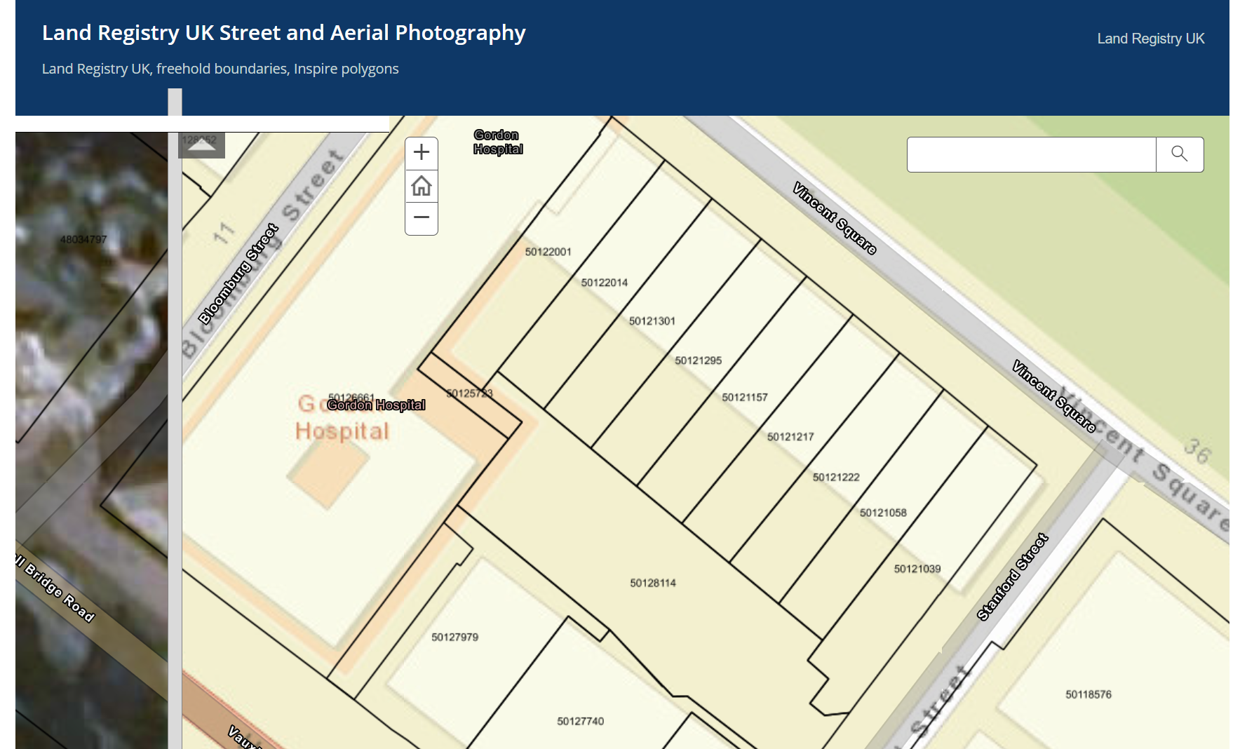
So in the UK, we can look at the land registry map and see the land divisions and also get the plot numbers, like this :-
Does anyone know how to access the Hungarian version to help me with my house searching? I was not sure if it existed, but I have seen screenshots of an almost identical looking map on some Hungarian property listings, but the web address is too small in the screenshots to be able to read it.
It's possible that its not available to the public, but I know for sure now that it does exist
Many Thanks
 Aug 12th 2021, 6:47 am
#2
BE Enthusiast
Joined: Jun 2011
Location: North East Hungary......for now
Posts: 646


If you visit the land registry (földhivatal) in the area concerned, you can view the maps free of charge. I think may be a charge if you want a copy. Not sure if you can do it online (I doubt it).
 Aug 12th 2021, 6:55 am
#3
BE Forum Addict
Joined: Nov 2012
Posts: 2,095
There is an equivalent at the Land Office (FÖLDHIVATAL) in the area of the property. They are free to view at the office but copies will cost about 10 quid - sorry I can't remember the exact amount. There is an online service but this is only available through the government online portal for which you need to be a Hungarian tax payer to access.
If you are going through an estate agent then I would expect the agent to be able to supply a map of the property in question.
If you are going through an estate agent then I would expect the agent to be able to supply a map of the property in question.
Last edited by Peter_in_Hungary; Aug 12th 2021 at 7:10 am.
Aug 12th 2021, 10:40 am
#4
Forum Regular
Joined: Jun 2020
Location: Keszthely
Posts: 116
There is a way to see the property boundaries and lot numbers using a paid webside, with out paying.
https://geoshop.hu/en/map
If you zoom in and select the area you are interested in, as if you are going to purchase, it gives you a preview showing the boundaries and lot numbers.
Bear in mind, sometimes you see land for sale which has not been registed yet. Once you have agreed to purchase, they then do the subdivision etc.
So on the geoshop site,
Zoom in and select the area using the drawing option.
Draw a shape that includes the land of interest.
Select proceed to products.
Select cadastral Map
Select build up area or rural depending on where you are selecting
If you zoom in enough you can see a preview showing what you will be purchasing, with the lot numbers and aproximate boundaries.
Otherwise;
if you find the local councils website, some of them (it is a bit hit and miss) have planning maps online as PDF or similar, that show all the land boudaries and development zones.
for example;
Rendezési terv
is the Cserszegtomaj council planing page (Near Keszthely north Balaton).
There are links to 5 maps part way down the page 'szabalyozasi terv'
This may help with some online investigation if you are not in Hungary yet.
Maybe there are other online options that I am not aware of too.
Aug 12th 2021, 2:24 pm
#5
BE Forum Addict
Joined: Nov 2012
Posts: 2,095
I tried geoshop and it works except that some buildings that have existed for in excess of 40 years (e.g.my house which is rural and another property I know in the local town) were not shown. Also it is not possible to scale (measure distance) from the preview. However it will give a good indication of the plot shape and its relative position
Aug 16th 2021, 8:10 pm
#6
Forum Regular
Thread Starter
Joined: Jul 2021
Posts: 73
Thanks guys, the geoshop explanation above does pretty much exactly what I wanted
