Tsunami Risk Map

Thread Tools
 
Old Nov 6th 2018, 12:19 am
  #1  
snɐןɔ ʎʇıuɐs
Thread Starter
 
GarryP's Avatar
 
Joined: Nov 2006
Posts: 6,558
GarryP has a reputation beyond reputeGarryP has a reputation beyond reputeGarryP has a reputation beyond reputeGarryP has a reputation beyond reputeGarryP has a reputation beyond reputeGarryP has a reputation beyond reputeGarryP has a reputation beyond reputeGarryP has a reputation beyond reputeGarryP has a reputation beyond reputeGarryP has a reputation beyond reputeGarryP has a reputation beyond repute
Default Tsunami Risk Map

Interesting little map showing the relative risk of tsunami around the country.


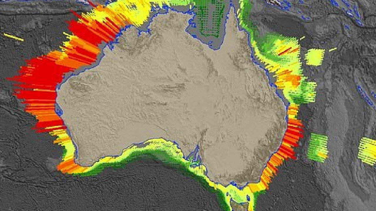
Probabilistic Tsunami Hazard Assessment (PTHA) | Geoscience Australia

https://www.news.com.au/technology/e...5216bff5de9037
GarryP is offline  

Posting Rules
You may not post new threads
You may not post replies
You may not post attachments
You may not edit your posts

BB code is On
Smilies are On
[IMG] code is On
HTML code is Off
Trackbacks are Off
Pingbacks are Off
Refbacks are Off


Contact Us - Archive - Advertising - Cookie Policy - Privacy Statement - Terms of Service -

Copyright © 2024 MH Sub I, LLC dba Internet Brands. All rights reserved. Use of this site indicates your consent to the Terms of Use.