

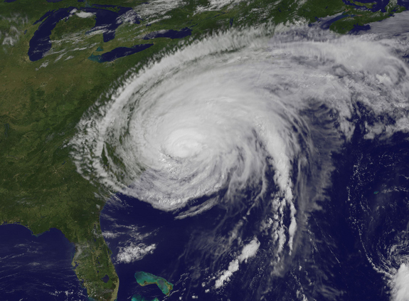
Hurricane Irene
 Aug 28th 2011, 1:51 am
#16
Gutter Gob!!

Joined: Feb 2005
Location: Perth
Posts: 13,098


We were in Nova Scotia in 2003 when Hurricane Juan, A cat 2 hurricane hit Halifax. It was quite honestly the most scary experience I have ever had.
 Aug 28th 2011, 2:32 am
#17
Demi-God
Joined: Oct 2008
Location: Far North Queensland
Posts: 2,812
A US classified category 1 storm could be as much as cat 3 in Australia. Cat 1 and cat 2 in Australia are both below 12 on the Beauforte scale. Cat one in the US is the point where the storm crosses from 11-12 on the Beauforte scale, cat 2 in the US is the stronger end of category 3 in Aus. Cat 3 in the US is cat 4 in Aus. See the table here: http://en.wikipedia.org/wiki/Tropical_cyclone
Not sure why this is, but it allows Aus media to over-dramatise cat 1 and 2 cyclones when in the rest of the world they are just classified as tropical storms, in fact cat 1 in Australia is about the same as an average winter storm in the UK.
Not sure why this is, but it allows Aus media to over-dramatise cat 1 and 2 cyclones when in the rest of the world they are just classified as tropical storms, in fact cat 1 in Australia is about the same as an average winter storm in the UK.
Aug 28th 2011, 2:37 am
#18
Lost in BE Cyberspace
Thread Starter
Joined: Jan 2009
Location: Brisbane
Posts: 20,821
 Aug 28th 2011, 2:52 am
#19
Possum. Amiculum. Latrina
Joined: Jan 2011
Location: Footloose
Posts: 3,427
A US classified category 1 storm could be as much as cat 3 in Australia. Cat 1 and cat 2 in Australia are both below 12 on the Beauforte scale. Cat one in the US is the point where the storm crosses from 11-12 on the Beauforte scale, cat 2 in the US is the stronger end of category 3 in Aus. Cat 3 in the US is cat 4 in Aus. See the table here: http://en.wikipedia.org/wiki/Tropical_cyclone
Not sure why this is, but it allows Aus media to over-dramatise cat 1 and 2 cyclones when in the rest of the world they are just classified as tropical storms, in fact cat 1 in Australia is about the same as an average winter storm in the UK.
Not sure why this is, but it allows Aus media to over-dramatise cat 1 and 2 cyclones when in the rest of the world they are just classified as tropical storms, in fact cat 1 in Australia is about the same as an average winter storm in the UK.
Aug 28th 2011, 2:57 am
#20
Home and Happy
Joined: Dec 2002
Location: Keep true friends and puppets close, trust no-one else...
Posts: 93,814
and
http://en.wikipedia.org/wiki/Tropical_cyclone_scales
Any tropical cyclone that forms to the east of 90°E in the Southern Hemisphere is monitored by either the Australian Bureau of Meteorology and or the Regional Specialized Meteorological Center in Nadi, Fiji. Both warning centres use the Australian tropical cyclone intensity scale, which measures tropical cyclones using a six category system. It is based on estimated maximum wind gusts, which are a further 30-40% stronger than the 10-minute average sustained winds. This is different from the Saffir-Simpson Hurricane Scale, which uses 1-minute maximum sustained winds.
Last edited by Pollyana; Aug 28th 2011 at 2:59 am.
Aug 28th 2011, 3:04 am
#21
Lost in BE Cyberspace
Thread Starter
Joined: Jan 2009
Location: Brisbane
Posts: 20,821
http://www.bom.gov.au/cyclone/about/
and
http://en.wikipedia.org/wiki/Tropical_cyclone_scales
Any tropical cyclone that forms to the east of 90°E in the Southern Hemisphere is monitored by either the Australian Bureau of Meteorology and or the Regional Specialized Meteorological Center in Nadi, Fiji. Both warning centres use the Australian tropical cyclone intensity scale, which measures tropical cyclones using a six category system. It is based on estimated maximum wind gusts, which are a further 30-40% stronger than the 10-minute average sustained winds. This is different from the Saffir-Simpson Hurricane Scale, which uses 1-minute maximum sustained winds.
 Aug 28th 2011, 3:05 am
#22
Possum. Amiculum. Latrina
Joined: Jan 2011
Location: Footloose
Posts: 3,427
http://www.bom.gov.au/cyclone/about/
and
http://en.wikipedia.org/wiki/Tropical_cyclone_scales
Any tropical cyclone that forms to the east of 90°E in the Southern Hemisphere is monitored by either the Australian Bureau of Meteorology and or the Regional Specialized Meteorological Center in Nadi, Fiji. Both warning centres use the Australian tropical cyclone intensity scale, which measures tropical cyclones using a six category system. It is based on estimated maximum wind gusts, which are a further 30-40% stronger than the 10-minute average sustained winds. This is different from the Saffir-Simpson Hurricane Scale, which uses 1-minute maximum sustained winds.
and
http://en.wikipedia.org/wiki/Tropical_cyclone_scales
Any tropical cyclone that forms to the east of 90°E in the Southern Hemisphere is monitored by either the Australian Bureau of Meteorology and or the Regional Specialized Meteorological Center in Nadi, Fiji. Both warning centres use the Australian tropical cyclone intensity scale, which measures tropical cyclones using a six category system. It is based on estimated maximum wind gusts, which are a further 30-40% stronger than the 10-minute average sustained winds. This is different from the Saffir-Simpson Hurricane Scale, which uses 1-minute maximum sustained winds.
Aug 28th 2011, 3:23 am
#23
Demi-God
Joined: Oct 2008
Location: Far North Queensland
Posts: 2,812
The point is that if you get a category 2 warning in the USA it's a LOT bigger than a cat 2 warning in Australia.
Aug 28th 2011, 3:36 am
#24
Rhino with a big horn!
Joined: Feb 2011
Posts: 3,117
A US classified category 1 storm could be as much as cat 3 in Australia. Cat 1 and cat 2 in Australia are both below 12 on the Beauforte scale. Cat one in the US is the point where the storm crosses from 11-12 on the Beauforte scale, cat 2 in the US is the stronger end of category 3 in Aus. Cat 3 in the US is cat 4 in Aus. See the table here: http://en.wikipedia.org/wiki/Tropical_cyclone
Not sure why this is, but it allows Aus media to over-dramatise cat 1 and 2 cyclones when in the rest of the world they are just classified as tropical storms, in fact cat 1 in Australia is about the same as an average winter storm in the UK.
Not sure why this is, but it allows Aus media to over-dramatise cat 1 and 2 cyclones when in the rest of the world they are just classified as tropical storms, in fact cat 1 in Australia is about the same as an average winter storm in the UK.

Never heard any of the big storms we regularly get down here being categorised even though they'd be like an average winter storm in the UK.
 Aug 28th 2011, 3:38 am
#25
Joined: Jun 2006
Posts: 4,555

It seems like they are more worried about flooding than wind damage. Katrina created a big scar in the US and no politician wants to repeat the mistakes.
Aug 28th 2011, 3:42 am
#26
Rhino with a big horn!
Joined: Feb 2011
Posts: 3,117
So, a category 1 US is like a category 3 Aus.
I don't think they make a drama out of category 1s down here. That was why I was surprised they were making a drama about it up there. The different scale explains why.
I don't think they make a drama out of category 1s down here. That was why I was surprised they were making a drama about it up there. The different scale explains why.
Aug 28th 2011, 4:03 am
#27
Home and Happy
Joined: Dec 2002
Location: Keep true friends and puppets close, trust no-one else...
Posts: 93,814
Cyclones have to form over warm water for one thing - one reason why the last Aus season was pretty active was because the water temps didn't drop as low as usual during winter, hence they were more conducive to cyclones forming earlier in the season.
The storms that impact Victoria generally form over colder Antarctic waters, and are low pressure areas, or depressions, but not cyclones. Even if a cyclonic system moves down the coast from Queensland, having started life up here as a cyclone, once it leaves tropical waters it ceases to be a cyclone as there isn't enough warmth to sustain it.
Cyclones off northern Australia typically develop between 5 and 15°S and reach maximum intensity between 10 and 20°S. As they move further south they will weaken over land or, for those remaining over water, weaken as they encounter an unfavourable environment (strengthening wind shear) and move over cooler water. They usually increase in speed as the steering winds in the mid-levels of the atmosphere increase and move to the south or southeast.
Occasionally a cyclone moves south and interacts with a mid-latitude trough and undergoes extra-tropical transition changing from a warm-cored tropical low to a cold-cored mid-latitude low. The structure, distribution of winds and rainfall changes significantly.
http://www.bom.gov.au/cyclone/faq/in...ml#definitions
Aug 28th 2011, 4:06 am
#28
Rhino with a big horn!
Joined: Feb 2011
Posts: 3,117
In order to be categorised as a cyclone (or Hurricane) a weather system has to meet more than just the wind speed - have a look at the BoM link I posted above.
Cyclones have to form over warm water for one thing - one reason why the last Aus season was pretty active was because the water temps didn't drop as low as usual during winter, hence they were more conducive to cyclones forming earlier in the season.
The storms that impact Victoria generally form over colder Antarctic waters, and are low pressure areas, or depressions, but not cyclones. Even if a cyclonic system moves down the coast from Queensland, having started life up here as a cyclone, once it leaves tropical waters it ceases to be a cyclone as there isn't enough warmth to sustain it.
Cyclones off northern Australia typically develop between 5 and 15°S and reach maximum intensity between 10 and 20°S. As they move further south they will weaken over land or, for those remaining over water, weaken as they encounter an unfavourable environment (strengthening wind shear) and move over cooler water. They usually increase in speed as the steering winds in the mid-levels of the atmosphere increase and move to the south or southeast.
Occasionally a cyclone moves south and interacts with a mid-latitude trough and undergoes extra-tropical transition changing from a warm-cored tropical low to a cold-cored mid-latitude low. The structure, distribution of winds and rainfall changes significantly.
http://www.bom.gov.au/cyclone/faq/in...ml#definitions
Aug 28th 2011, 4:20 am
#29
Mostly Harmless
Joined: Jan 2010
Location: Semi-rural wonderworld, Brisbane
Posts: 15,109