

FLASH FLOOD WARNING DOWNSTREAM FROM TOOWOOMBA/ BRISBANE FLOODING
 Jan 10th 2011, 11:23 pm
#61
Lost in BE Cyberspace

Joined: Jan 2009
Location: Brisbane
Posts: 20,821


I would estimate the river is at least 10 metres higher than normal. It used to be a long way down at the edge here. Not anymore. If it peaks tomorrow afternoon we may be flooded and cut off.
Ridgecrest St, Kenmore.


You can see the river from the top this little hill which we've never seen before. So it's getting really high.

Same pic as above but zoomed out on top of the hill.

Ridgecrest St, Kenmore.
You can see the river from the top this little hill which we've never seen before. So it's getting really high.
Same pic as above but zoomed out on top of the hill.
Last edited by Alfresco; Jan 10th 2011 at 11:25 pm.
 Jan 10th 2011, 11:23 pm
#62
BE Forum Addict
Joined: Mar 2009
Posts: 1,412
Any danger in Brisbane CBD? Girlfriend's work are now evacuating, partially because everyone has to move their cars. I'm a block over from them and have an important lecture at 2:30pm that I don't want to miss. High tide is 2pm.
Jan 10th 2011, 11:48 pm
#63
BE Forum Addict
Joined: Mar 2009
Posts: 1,412
Uni closed. Told to go home.
Jan 10th 2011, 11:49 pm
#64
Frequent Flyer Member
Joined: Jun 2007
Location: Melbourne
Posts: 10,994
BOM Info for Brisbane City:
At the Brisbane City Gauge (lower end of Edward Street and at Thornton Street),
minor flood levels of about 2.1 metres are expected with the afternoon high tide
on Tuesday and moderate flood levels of 2.6 metres with the overnight high tide.
Higher flood levels to 3.5 metres (major) are expected with the high tide on
Wednesday afternoon. Levels above 3.5 metres are expected on Thursday.
(3.5 metres at the Brisbane City gauge is about 2.5 metres higher than the
highest tide of the year at this location).
http://www.bom.gov.au/cgi-bin/wrap_fwo.pl?IDQ20805.html
Jan 10th 2011, 11:53 pm
#65
Account Open
Joined: Jan 2005
Location: Brisbane
Posts: 4,298
There is a small chance of extremely high rainfall in the Brisbane area, just as occurred near Toowoomba. If this happens, dangerous flash flooding may occur.
The biggest concern for Brisbane residents is the level of the wivenhoe dam, it will be at approx 2.1million ML right now. Total capacity is 2.6million ML. If capacity exceeds 2.6million then the downstream areas will be exposed to potentially significant flooding, depending on the amount of subsequent rainfall in the catchment.
Right now, there is heavy rainfall all across the catchment and 100% of this will be heading for the dam.
Jan 10th 2011, 11:55 pm
#66
Mostly Harmless
Joined: Jan 2010
Location: Semi-rural wonderworld, Brisbane
Posts: 15,109
BOM Info for Brisbane City:
At the Brisbane City Gauge (lower end of Edward Street and at Thornton Street),
minor flood levels of about 2.1 metres are expected with the afternoon high tide
on Tuesday and moderate flood levels of 2.6 metres with the overnight high tide.
Higher flood levels to 3.5 metres (major) are expected with the high tide on
Wednesday afternoon. Levels above 3.5 metres are expected on Thursday.
(3.5 metres at the Brisbane City gauge is about 2.5 metres higher than the
highest tide of the year at this location).
http://www.bom.gov.au/cgi-bin/wrap_fwo.pl?IDQ20805.html
At the Brisbane City Gauge (lower end of Edward Street and at Thornton Street),
minor flood levels of about 2.1 metres are expected with the afternoon high tide
on Tuesday and moderate flood levels of 2.6 metres with the overnight high tide.
Higher flood levels to 3.5 metres (major) are expected with the high tide on
Wednesday afternoon. Levels above 3.5 metres are expected on Thursday.
(3.5 metres at the Brisbane City gauge is about 2.5 metres higher than the
highest tide of the year at this location).
http://www.bom.gov.au/cgi-bin/wrap_fwo.pl?IDQ20805.html
http://www.bom.gov.au/fwo/IDQ65389/I...0198.plt.shtml
MIL has decided to come home early from the city and the OH is heading back from the airport later. According to reports that is expected to stay open all day.
Not a day (or two) to be travelling anywhere unless necessary I'd wager.
Jan 11th 2011, 12:16 am
#67
Lost in BE Cyberspace
Joined: Dec 2008
Posts: 6,039
Ipswich looks at risk at the moment.
Most employees from Ipswich left an hour or so ago. Ipswich now cut off in both directions.
Most employees from Ipswich left an hour or so ago. Ipswich now cut off in both directions.
Jan 11th 2011, 12:25 am
#68
Lost in BE Cyberspace
Joined: Dec 2008
Posts: 6,039
Toowoomba yesterday - usually a small creek through the CBD.
Jan 11th 2011, 12:29 am
#69
Forum Regular
Joined: Aug 2007
Location: UK again
Posts: 219
And there is a historical plot here:
http://www.bom.gov.au/fwo/IDQ65389/I...0198.plt.shtml
MIL has decided to come home early from the city and the OH is heading back from the airport later. According to reports that is expected to stay open all day.
Not a day (or two) to be travelling anywhere unless necessary I'd wager.
http://www.bom.gov.au/fwo/IDQ65389/I...0198.plt.shtml
MIL has decided to come home early from the city and the OH is heading back from the airport later. According to reports that is expected to stay open all day.
Not a day (or two) to be travelling anywhere unless necessary I'd wager.
Look at the low tide level just gone, it is nearly the same as saturdays high tide level
Jan 11th 2011, 12:29 am
#70
Lost in BE Cyberspace
Joined: Dec 2008
Posts: 6,039
From Queensland Police:
All residents in low lying areas of Strathpine and Caboolture should evacuate immediately. Cars should be moved from low lying areas. The flood levels are expected to be greater than the 1974 floods. Do not stay in your homes please leave immediately.
Strathpine and Caboolture are outer northern suburbs of Brisbane.
Jan 11th 2011, 12:29 am
#71
Account Open
Joined: Jan 2005
Location: Brisbane
Posts: 4,298
very heavy, constant rain up here in north west brisbane right now.
looking at the radar, cleveland and the area south-east of the city seem to be getting off scot-free
looking at the radar, cleveland and the area south-east of the city seem to be getting off scot-free
Jan 11th 2011, 12:38 am
#72
Mostly Harmless
Joined: Jan 2010
Location: Semi-rural wonderworld, Brisbane
Posts: 15,109
And I am very glad of that believe me. But there is time for all that to change ... we got months of this to come ...
Jan 11th 2011, 12:42 am
#73
Mostly Harmless
Joined: Jan 2010
Location: Semi-rural wonderworld, Brisbane
Posts: 15,109
From Queensland Police:
All residents in low lying areas of Strathpine and Caboolture should evacuate immediately. Cars should be moved from low lying areas. The flood levels are expected to be greater than the 1974 floods. Do not stay in your homes please leave immediately.
Strathpine and Caboolture are outer northern suburbs of Brisbane.
All residents in low lying areas of Strathpine and Caboolture should evacuate immediately. Cars should be moved from low lying areas. The flood levels are expected to be greater than the 1974 floods. Do not stay in your homes please leave immediately.
Strathpine and Caboolture are outer northern suburbs of Brisbane.
Jan 11th 2011, 12:45 am
#74
Lost in BE Cyberspace
Joined: Dec 2008
Posts: 6,039
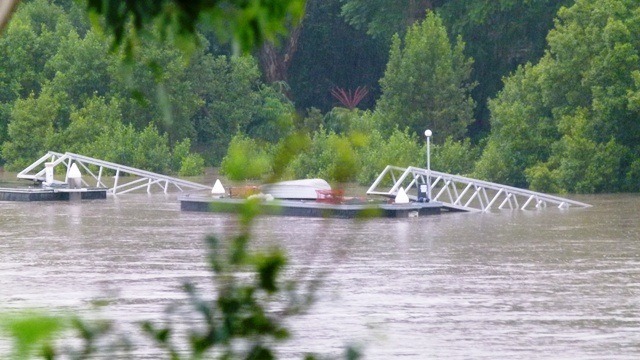
Caboolture 10 minutes ago
Jan 11th 2011, 1:26 am
#75
Forum Regular
Joined: Aug 2007
Location: UK again
Posts: 219